Posts

Showing posts from September, 2020

Cedar Swamp Wildlife Area: A Vanished Resort and Vanished House

Image
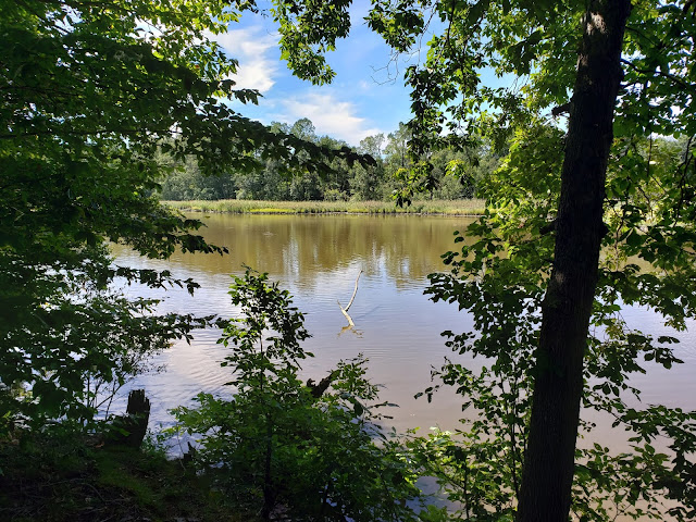
  Boaters off the boat ramp at the end of Collins Beach Road in Cedar Swamp Wildlife Area One of the most remote spots we’ve encountered so far along the Delaware Bay Shore Byway is Cedar Swamp Wildlife Area. Phone and GPS signals are spotty. Like many of Delaware’s wildlife areas, its limited development has focused on the needs of hunters and boaters. There are no wildlife viewing trails or information kiosks here. But there were once two significant historic spots here that we tried--and failed--to seek out.  One was Collins Beach, one of the beach resorts developed along the Delaware River and Bay during the 1800s. A hotel called Hygenia House  was built there in 1850 and a pier for a steamboat added in 1856. Eventually the resort had a restaurant, dance hall, merry-go-round, and bath houses.  Illustration of Collins Beach, with Hygenia House on left, from a wayfinding sign at Woodland Beach Wildlife Management Area Tragedy struck in 1878, when a tidal wave from a hurricane washed

Blackbird Creek Reserve: A Pleasant Walk and Interesting Historic Sites Nearby

Image
  Blackbird Creek  A couple of miles south of Odessa is Blackbird Creek Reserve. We spent a pleasant morning over Labor Day weekend visiting it and seeing some nearby historic buildings. Blackbird Creek Reserve has three short, easy trails. You can download a map of the trails, but at the park they’re also clearly marked with color-coded markers.  Trail signpost at Blackbird Creek Reserve We took the 2-kilometer yellow trail, which looped through woods and open areas and gave us glimpses of Blackbird Creek. The trails are mowed grass, which makes for a pleasant, comfortable walk.  Part of the Blackbird Creek Reserve yellow trail Some of the trees are labeled.  There’s birdwatching station near Blackbird Creek.  Birdwatching station at Blackbird Creek Reserve We paused here…and saw a bird fly in and land in the creek! It was too far away for us to tell what kind of bird it was.  Is it a crane? egret? heron? An open area has been transformed into a nursery for native plants. 

Ashton Tract of Augustine Wildlife Area: Nature and History Converge

Image
View of Thousand Acre Marsh from the Ashton Tract of Augustine Wildlife Area Between the Chesapeake & Delaware Canal and Odessa are several tracts of land that make up Augustine Wildlife Area. Many of Delaware’s wildlife areas are either undeveloped or have been developed primarily to meet the needs of those interested in hunting, fishing, and boating. A lot don't yet have restrooms, signage, developed trails, or other features of interest to other visitors. One of the exceptions is the Ashton Tract of Augustine Wildlife Area, just south of the Chesapeake & Delaware Canal. It’s worth a stop for two reasons.    First, features have been added for wildlife enthusiasts and photographers. There’s a parking area, rest rooms, a kiosk with helpful information, and a wayfaring sign with information on the kinds of wildlife that live here.    Ashton Tract wayfinding sign There’s also a new wildlife viewing/photography platform with great views looking north over Thousand A

Liston Range Lighthouses: A Lesson in River Navigation

Image
While Peter Stuyvesant was able to navigate the Kalmar Nychel up the Delaware River to Wilmington in 1638, the river is not deep enough to accommodate modern ships. Since 1885 a channel dug into the center of the river has been used by large ships going to Wilmington and Philadelphia. If you’ve ever seen a map of the Delaware River, you know it isn’t straight—there are several sharp bends. Before modern satellites and GPS, it would have been hard to navigate around these bends and stay in the channel. So lighthouses were installed at key points along the river to help guide ships. Sometimes navigating the channel was so difficult that one lighthouse wasn’t enough. Two were needed: a short one on the coast and a second, taller one inland. When the lights of the two lighthouses lined up vertically, one on top of the other, the ship was in the channel. These pairs of lighthouses are called range lighthouses. The Liston Range Lighthouses are an example of this. The Liston Rear Range

Port Penn: A Well-Preserved Early American River Town

Image
 We spent a lovely morning this week exploring the fascinating little town of Port Penn.  Port Penn is named for (wait for it) William Penn, who stopped here briefly for fresh water on his way to landing in New Castle in 1682. It was an informal village until the mid-1700s, when David Stewart envisioned Port Penn as a major port rivaling Philadelphia, shipping local agricultural products. He laid out streets and lots in the grid pattern often seen in large cities. While Port Penn was busy through the mid-1800s, it never achieved Stewart’s vision. Competition from the Chesapeake & Delaware Canal and railroads put an end to its development. Today the town is little more than about two square blocks, with virtually no buildings built in the last hundred years and 80% built before 1868. While many of the buildings have been altered over the years and covered with modern siding, it’s easy to envision how the town looked 150 years ago. You'll see a town of working-class people who ma